
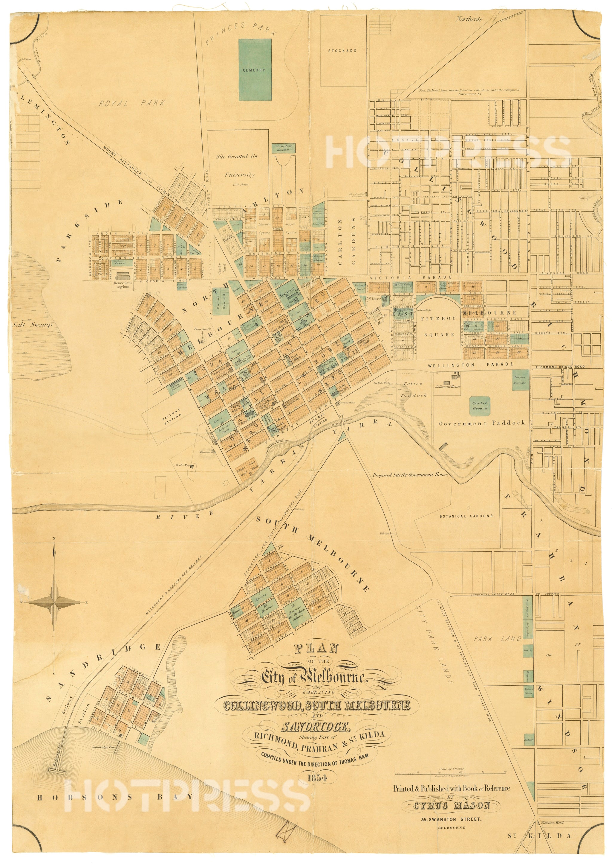
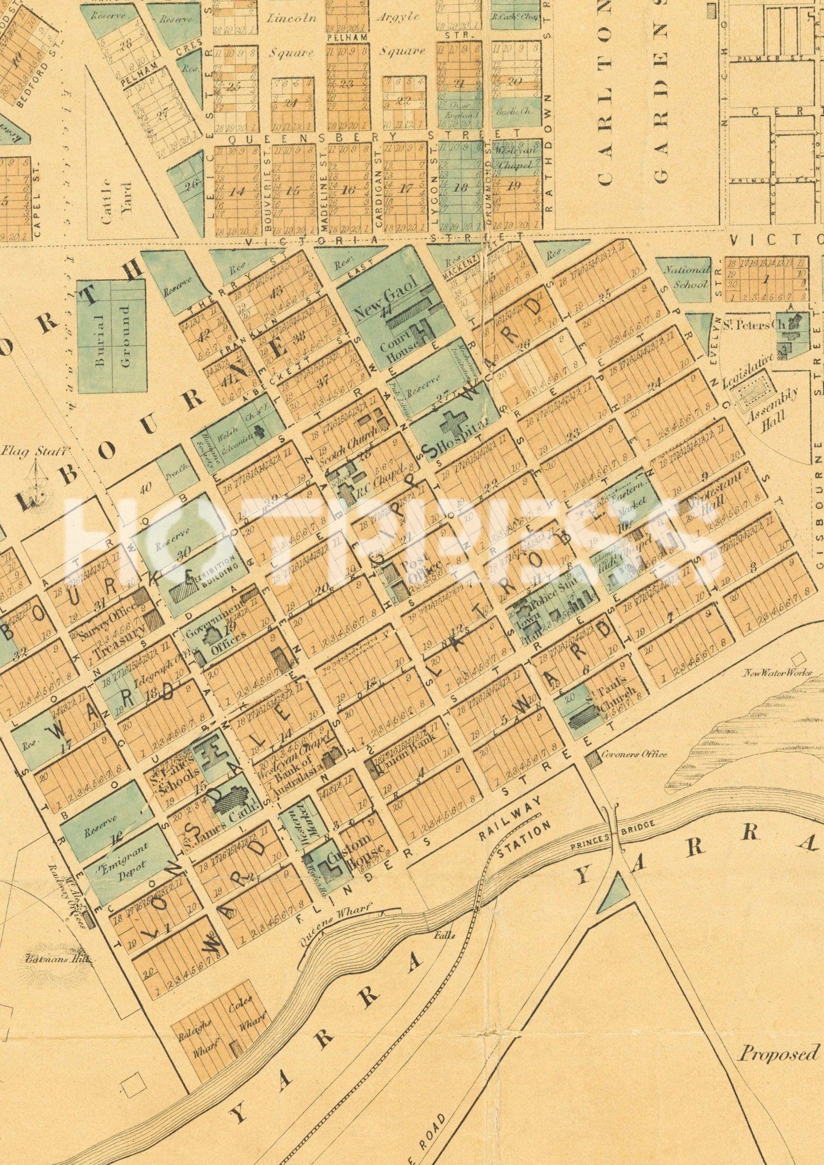
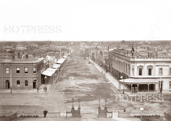
1854 Plan of the City of Melbourne
MM_1058
$10.50
An interesting map of the City of Melbourne in 1854. Melbourne was well into its suburban growth, mainly from the benefits of the Gold Rush.
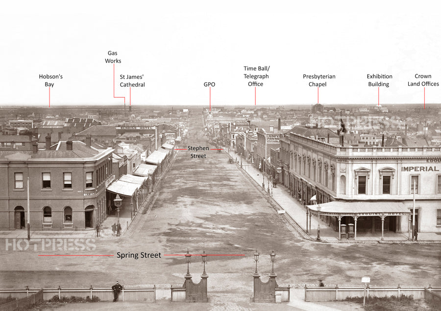
The "Melbourne & Hobsons Bay Railway Line" commenced operation in the year of 1854, running from Railway Pier and terminates in Flinders Street at the base of Elizabeth Street.
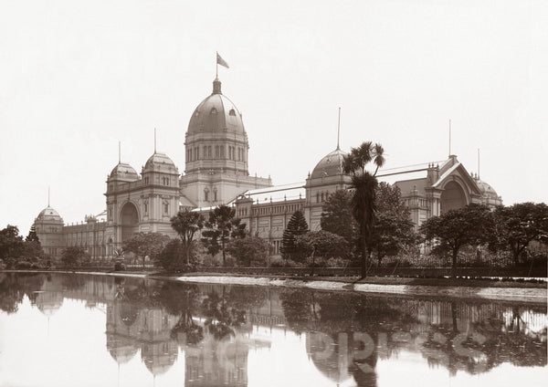
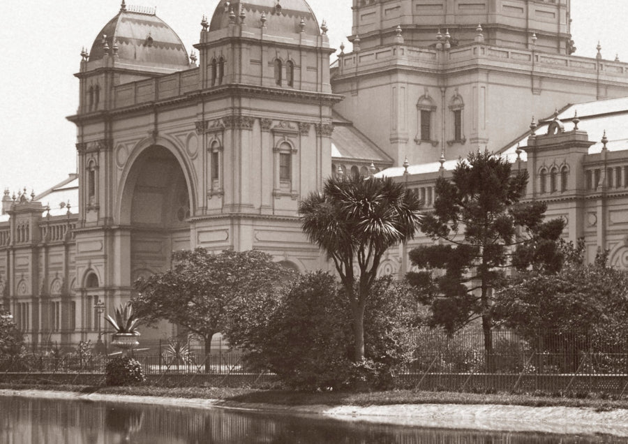
The original Exhibition Building (sited where the current Royal Mint Building is now, on the corner of William and Lonsdale) opened in this year of 1854, and can be found on this map.
The first Princes Bridge, shown on the map, opened in 1851.
All text © HotPress
The notes from the State Library describe this image as a "Plan of the City of Melbourne, embracing Collingwood, South Melbourne and Sandridge, shewing part of Richmond, Prahran and St Kilda."
This is a digitally retouched reproduction of the original held by the State Library of Victoria. All prints are reproduced without the HOTPRESS watermarks.
Our team of conservators have worked on a high resolution digital image in order to remove blemishes and artifacts such as stains, mould, scratches and damage caused by the handling of the original. We strive to provide authentic representations of the original work that are suitable for enlargements that retain the tones and character of the original.
