
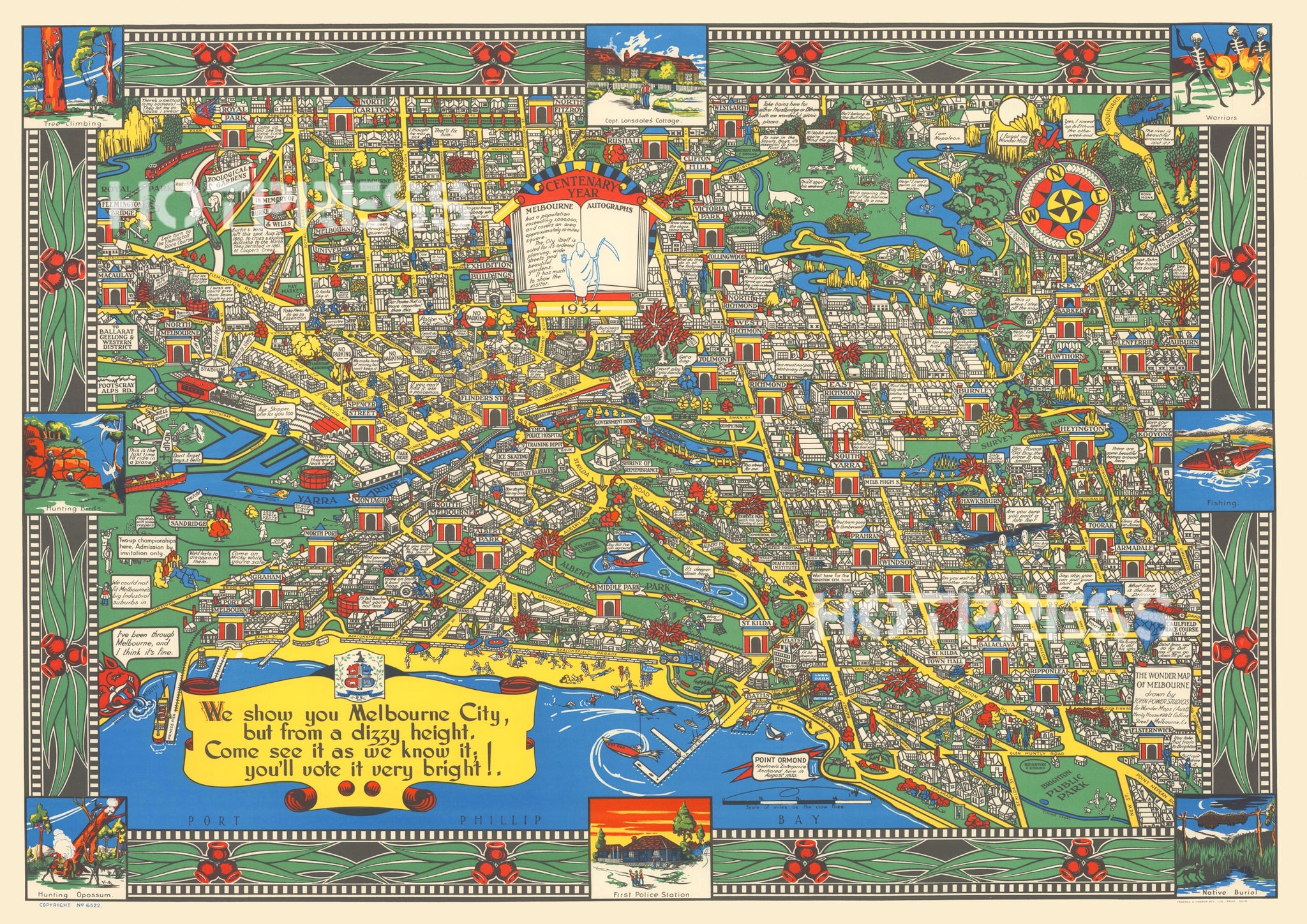
1934 Centenary Wonder Map of Melbourne
MM_1056
$10.50
In 1934, Victoria celebrated its Centenary, along with Melbourne's Centenary in 1935. This colourful map was produced for visitors and residents to inform and remind them of our brief but incredible history and achievements.
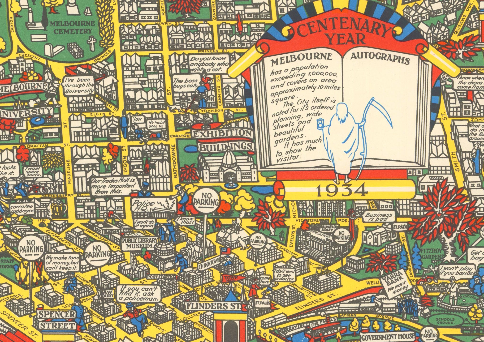
The central panel reads : 'Centenary Year. Has a population exceeding 1,000,000 and covers an area approximately 10 miles square. The city itself is noted for its ordered planning, wide streets and beautiful gardens. It has much to show the visitor.’ next to which is a space for autographs. Printed by Troedel & Cooper.
All text © HotPress
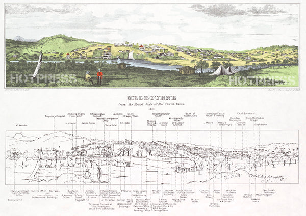
Notes from the State Library of Victoria tell us that this map is "The wonder map of Melbourne [cartographic material] / drawn by John Power Studios."
This is a digitally retouched reproduction of the original held by the State Library of Victoria. All prints are reproduced without the HOTPRESS watermarks.
Our team of conservators have worked on a high resolution digital image in order to remove blemishes and artifacts such as stains, mould, scratches and damage caused by the handling of the original. We strive to provide authentic representations of the original work that are suitable for enlargements that retain the tones and character of the original.